Quick Summary
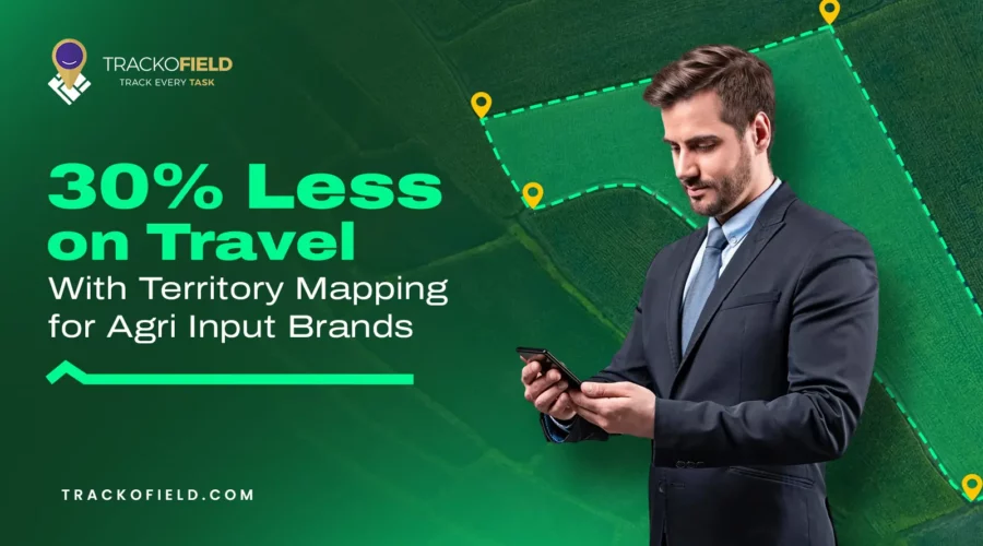
- An Agri input brand reduced travel expenses by 30% through effective territory mapping and beat planning using TrackoField.
- The brand faced challenges like overlapping territories and disorganized routes, leading to high travel costs and low dealer coverage.
- Implementing geofencing allowed for precise territory assignments, improving accountability and visibility of field operations.
- The results included increased dealer visits, reduced travel time, and enhanced field activity reporting, showcasing the importance of territory mapping for Agri brands.
Explore how one Agri brand cut travel costs by 30% using territory mapping, beat planning & field team tracking with TrackoField.
We remember onboarding an agri inputs selling client who came to us with a familiar challenge—field teams on the move, making big efforts but lacked clear structure. Their field reps were unknowingly visiting the same areas which was adding to their costly fuel bills.
Thinking it’s your story too? Well, it’s a common story in rural sales. But with a little help from our agri field force automation software—specifically for territory mapping and beat planning—they turned things around fast.
Read on how they cut travel expenses by 30%, without cutting corners.
Challenges Leaking This Agri-input Brands’ Revenues? Inefficient Territory Coverage & High Travel Costs!
Within a span of 12 years, this famous agri input brand had expanded rapidly across rural India. But their growth called for some real headaches. Their field sales reps were quite more often on the road than they should.
Their reps. would cluelessly roam to same farms and would often cross paths with other reps. who were unknowingly visiting the same areas. This was messing them in reaching their top agri-input KPIs.
All in all, their visits were mostly unclear and routed towards wasted efforts.
What Were They Specifically Battling With?
- Their team was overlapping territories which lead to wasted visits.
- Travel routes of their teams were disorganized. This added to more travel time and fuel costs.
- Low dealer coverage. This was due to unorganised itinerary and beat plans.
- Lack of visibility of on-ground execution teams as mostly were visiting low-network areas.
💡What their team was lacking?
Their field teams lacked:
- Structured travel or beat plans with details
- Proper shift and task schedules
Most of them were just using their memory to plan their day. This not only reduced productivity but also caused the company to incur high travel reimbursements, especially for fuel and lodging.
Their Field Ops Weren’t Working—Until This Field Force Automation Software Stepped In
Here’s how that leveraged field force automation software by TrackoField experienced some aid to their pain points.
Step 1: Easy Implementation of Territory Mapping with Geofences
With the software’s geofencing capabilities, the brand was able to assign geo-tagged territories to its on-field agents. Instead of assigning vague locations, regions, they strategically mapped out each territory based on village or farms clusters and precise pin codes.
The best part? They could create multiple geofences across village clusters with custom name and code that would be visible live over a map.
This allowed their business to:
- Assign non-overlapping territories to each rep.
- Ensure location & equal workload distribution across regions
- Identify uncovered dealer pockets
- Set clear accountability for every area
By visualizing territory distribution on a map, they could finally see where overlaps were happening and where gaps existed.
💡 Bonus Impact: Territory mapping helped fix broken farmer onboarding as managers could assign territories quickly and train based on clear geographical boundaries.
Step 2: Easy Creation of Optimized Task Schedules & Beat Plans
With sales territories now clearly defined, the next step we introduced them with our built-in task management system for effortless task assigning & beat planning.
Through this, each field rep was guided to plan their week in advance using proximity-based logic:
- Cover nearby dealers first before covering far off ones
- Minimize efforts by setting a logical sequence of visits
- Prioritize high-volume dealers for frequent touchpoints
- Rotate visits to low-priority outlets on a bi-weekly or monthly basis
💡 The brand used digital tools to log visit history, allowing managers to ensure that no dealer was being ignored or visited too frequently without reason. The result was a more structured and measurable sales visits & farmer onboarding routine.
Step 3: Digitalised Field Execution
Previously, field execution was logged manually through WhatsApp messages or spreadsheets—if at all. To improve visibility, the company deployed a field force automation tool that allowed their field managers/supervisors to:
- View each staff’s geo-verified & timestamped dealer visits
- Review daily visits, distance & sales orders logs
- Track live task progress and routes and monitor deviations
This digitization played a crucial role in reducing misuse of travel reimbursements, as field activities could now be verified with evidence.
The Results They Got: Reduced Travel Time & Reimbursement Claims!
Within three months of implementing territory mapping and beat optimization, the company witnessed strong operational improvements:
- 30% less total travel reimbursements
- 25% more daily dealer visits/rep
- 2x better field coverage in underserved areas in the past
- Lower travel time and fuel consumption
- More accurate field activity reporting, helpful for the brand to make data-driven decisions
💡 More importantly, the field team became effortlessly motivated. Since their travel was minimized, they had more time to engage with retailers and farmers to focus on business prospects.

Supercharge Your Agri-Input Sales with Smart Territory Mapping
Why Territory Mapping is so Important for Ari Input Brands?
You would agree that in agri-input distribution, reaching to rural markets is everything. But antiquated travel and visit planning methods are not sufficient to expand reach & networks in the market. As the competitive pressure is rising, costs are doubling, agri input brands must find smarter ways to operate.
Territory mapping and beat planning are no longer “nice-to-haves.” They have become critical tools that drive both growth & efficiency.
Looking to Do the Same? TrackoField Can Help
Operational excellence in agri input businesses comes from working smarter. You need right structure, visibility, and tools, your field teams can cover more ground, at lower cost, and with higher impact. Just like this agri input brand did.
TrackoField is a leading field force management software built for agri businesses that want to scale without losing visibility. Our platform helps you:
- Map and assign territories based on pin codes
- Create smart beat plans and monitor daily activity
- Track field reps locationl & activities with GPS-enabled check-ins
- Analyze field performance data to find growth opportunities
Whether you’re looking to cut costs, improve coverage, or drive more sales through your dealer/farmer network, TrackoField gives you the tools to execute your vision.
Ready to optimize your field operations? Book a demo today and see how TrackoField can make every kilometer count.

FAQs
What is territory mapping and how does it help agri-input brands?
Territory mapping divides rural regions into clearly defined sales zones. It ensures sales reps. don’t overlap same areas and every sales area gets proper coverage. It helps cut travel time and improve work efficiency.
Can this system work in low-network or remote areas?
Yes. TrackoField supports offline data logging and syncs automatically when back online, making it ideal for rural and low-network zones.
Is it hard to implement TrackoField for my team?
Absolutely not! TrackoField comes with a very intuitive & simple-to-use interface. Any member of your team, be it sub managers, HRs, executives can use it effortlessly. To help navigate new features TrackoField what’s new is shared every month.
How did territory mapping reduce travel expenses by 30% for an agri-input brand?
Territory mapping in TrackoField helped by assigning non-overlapping territories and optimizing beat plans. It helped the brand minimize redundant visits, routes that lowered teams travel costs & reimbursement claims.
How does beat planning improve daily sales activities?
Smart beat planning helps reps organize their visits by proximity and priority, reducing travel time and increasing the number of dealer visits per day.

Nandita is the Team Lead for Content Marketing at TrackoBit, bringing over a decade of experience in B2B, B2C, and IoT sectors. She has a proven track record of helping Read More

Related Blog

TrackoField’s AI Manager Bot: Instant Answers for Clarity
Why click through multiple reports when you can simply ask? Explore how TrackoField’s AI manager bot offers real-time answers to…
Loan Origination System vs Loan Management System: Key Differences & How it works
Compare loan origination system vs loan management system and how they differ in managing loan approvals, disbursement, collections, and tracking…

10 Best Territory Management Software for Field Sales Teams in 2026
The best territory management software can group customers by variables. It includes risk tier, sales cycle lengths, and loan sizes…
What Is Territory Management? A Complete Guide for Field Sales Teams
Check out the complete guide to territory management for field sales teams. Learn how software like TrackoField improves coverage and…

Your inbox awaits a welcome email. Stay tuned for the latest blog updates & expert insights.
"While you're here, dive into some more reads or grab quick bites from our social platforms!"Stay Updated on tech, telematics and mobility. Don't miss out on the latest in the industry.